
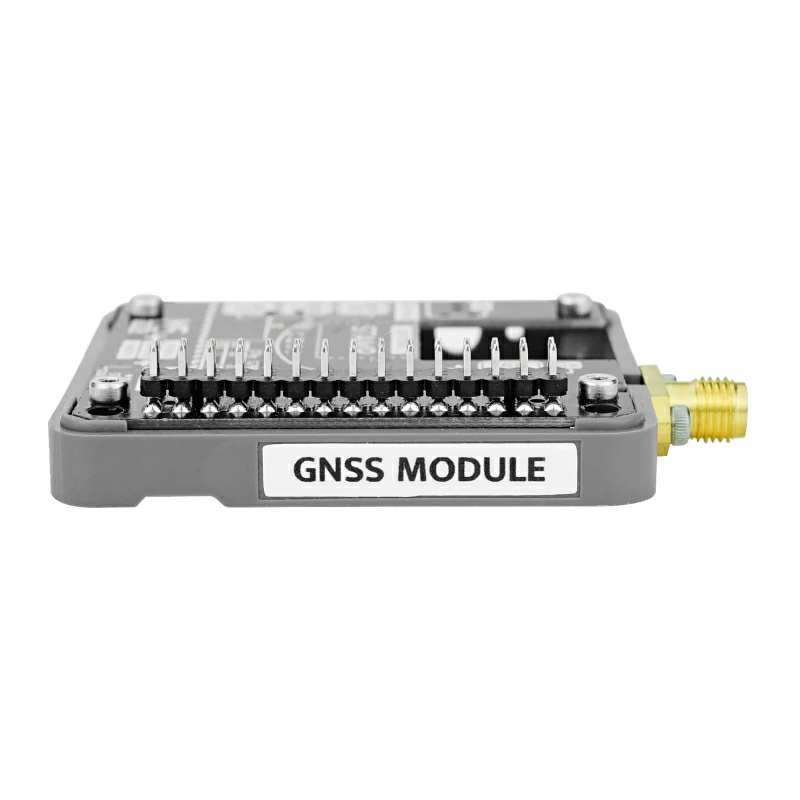
Module GNSS
SKU:M135
Description
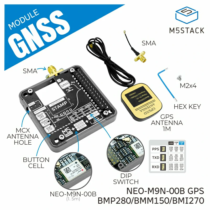
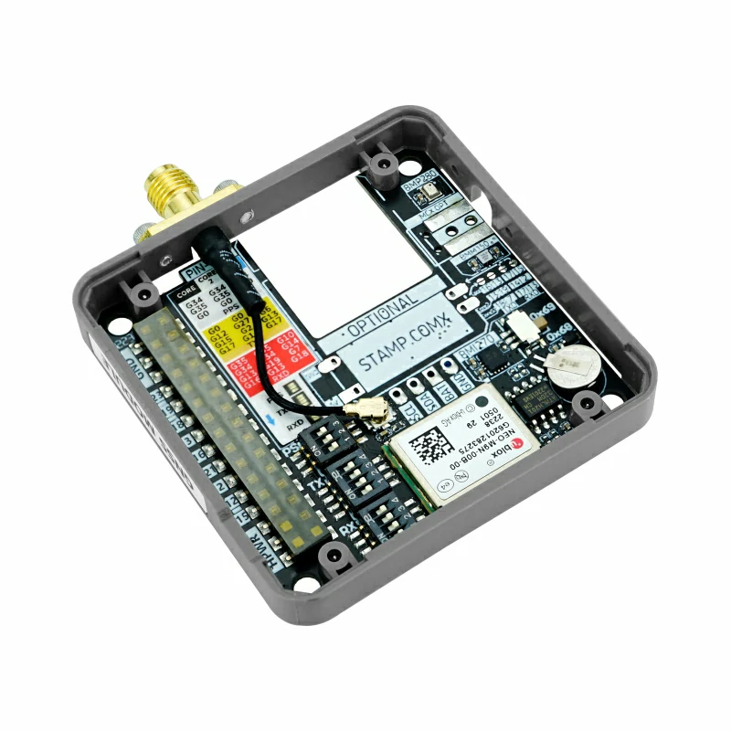
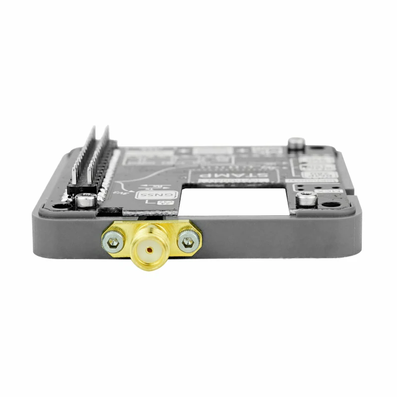
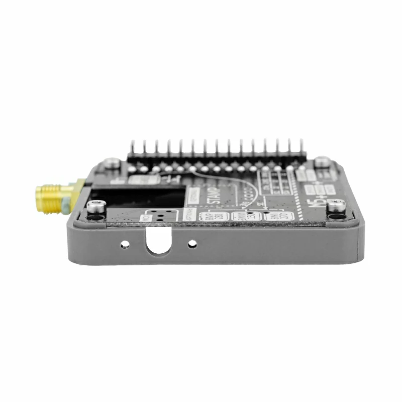
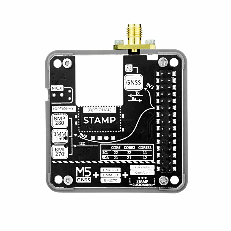
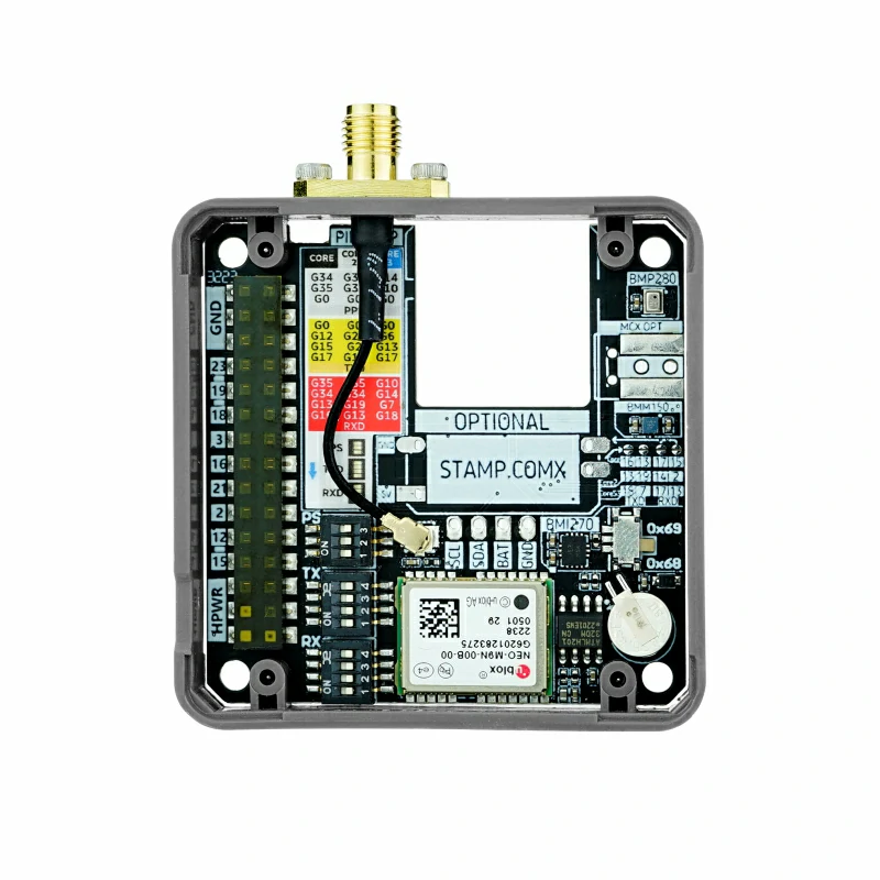
Module GNSS is a multifunctional global positioning communication module, built with a NEO-M9N-OOB high-precision GNSS positioning module, supporting multiple satellite signal receptions. It also integrates a six-axis motion sensor (BMI270), three-axis magnetometer (BMM150), and barometric pressure sensor, enabling comprehensive measurement of location, orientation, altitude, and other geographic information. The module reserves an expansion slot for the M5Stamp series, allowing for additional IoT communication functions. It is suitable for applications in navigation, agriculture, logistics, land surveying, and environmental monitoring.
Features
- Multi-satellite positioning: Supports multiple satellite systems (GPS, GLONASS, Galileo, BeiDou) for accurate positioning.
- High precision: Positioning accuracy is about 1.5 meters.
- Multi-signal reception: Receives four GNSS signals simultaneously for more accurate positioning.
- External antenna: Optional configuration to meet different needs.
- Data protection: Backup battery and EEPROM chip ensure data safety during power outages.
- Multi-sensor integration: Includes a 6-axis IMU, magnetometer, and barometric pressure sensor.
- Flexible configuration: Customizable UART pins, PPS sync signal pins, and more.
- Multi-industry applications: Suitable for positioning, agriculture, logistics, environmental monitoring, etc.
- IoT support: Expandable with M5Stamp wireless communication modules for remote communication.
Includes
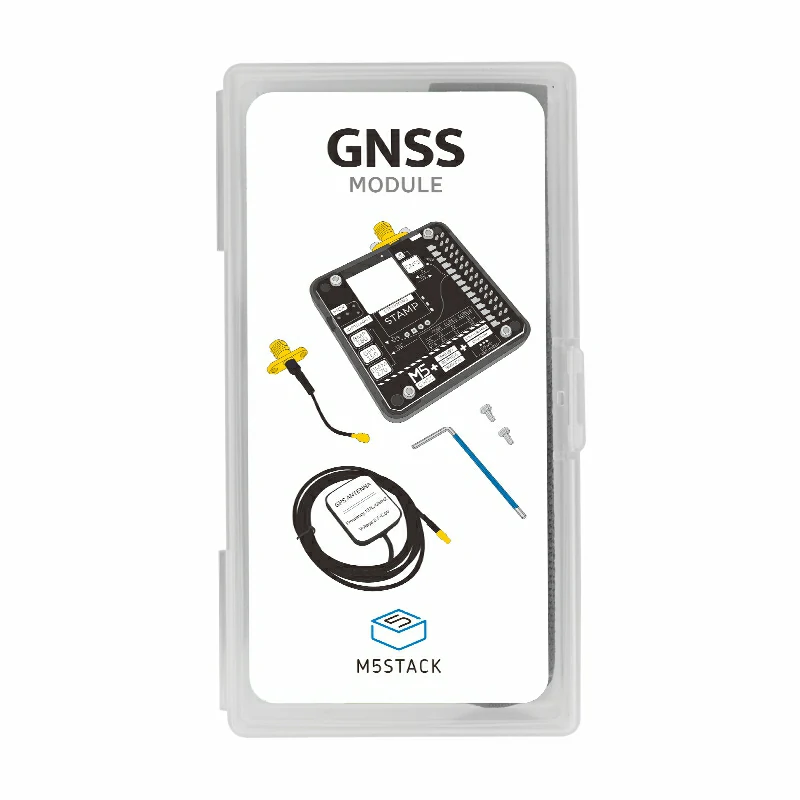
- 1 x Module GNSS
- 1 x External active GPS/BD antenna (length: 1m)
- 1 x Antenna feeder cable
- 2 x M2*4 Screws
- 1 x Hex Key L-Shape 1.5mm
Applications
- Navigation and positioning
- Agriculture
- Logistics
- Land surveying
- Environmental monitoring
Specifications
| Specification | Parameter |
|---|---|
| GNSS Chip | NEO-M9N-00B Accuracy: 1.5m Operational limits: Max altitude: 80000m; Max acceleration: 4G; Max speed: 500m/s Supported channels: 92 Dynamic heading accuracy: 0.3° Max navigation update rate: 25Hz |
| 6-Axis IMU | BMI270 Accelerometer range: ±2g/±4g/±8g/±16g Gyroscope range: ±125dps/±250dps/±500dps/±1000dps/±2000dps |
| 3-Axis Magnetometer | BMM150 (Magnetic field resolution: 0.3uT) |
| Barometric Sensor | BMP280 (Measurement range: 300 ~ 1100 hPa) |
| Supported GNSS | GPS / QZSS, GLONASS, Galileo, BeiDou |
| Baud Rate | Default 38400bps 8N1 |
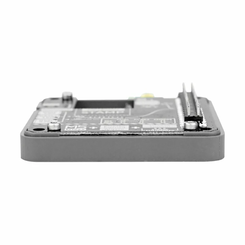
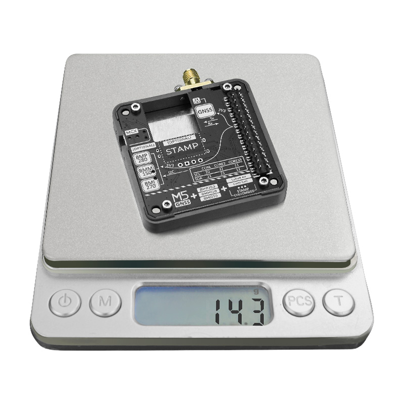
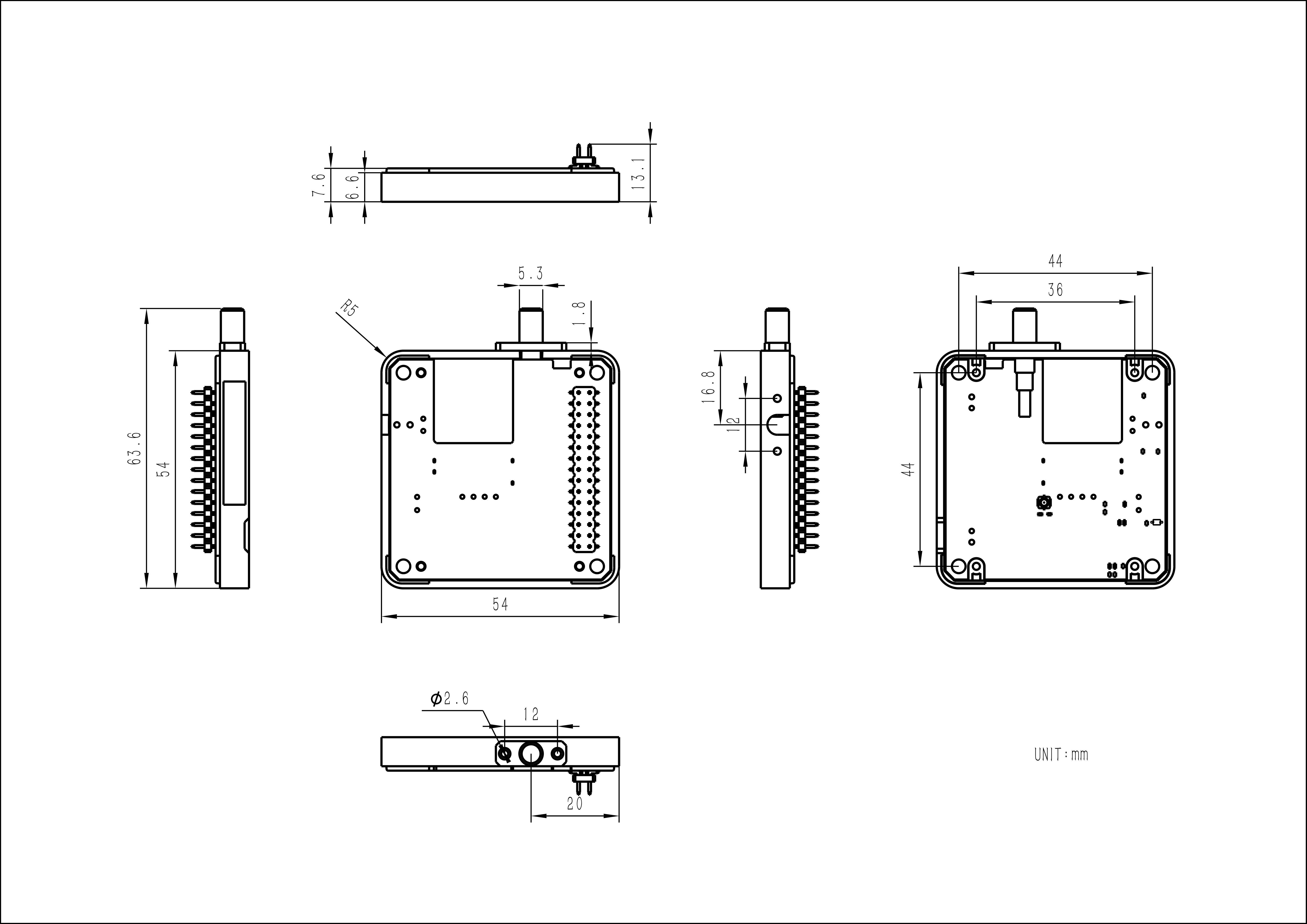
| Product Size | 54.0 x 54.0 x 13.1mm |
| Product Weight | 14.3g |
| Package Size | 126.0 x 67.0 x 23.0mm |
| Gross Weight | 80.0g |
Learn
BMM150 Magnetic Field Interference
Products with magnets may interfere with the BMM150 magnetic field sensor, causing abnormal readings. When used with M5 controllers that have built-in magnets, remove the magnets and avoid placing the BMM150 sensor near strong magnetic fields.
Signal Quality
To achieve good signal reception, place the GPS module outdoors during use.
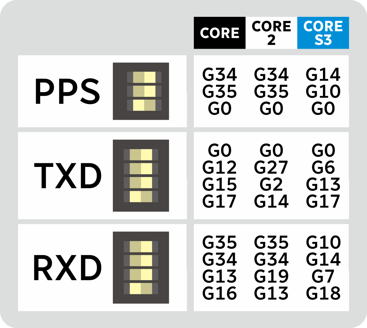
Reserved DIP switches and toggles can be used to adjust UART pin assignments, timestamp PPS pin, and IMU communication addresses.
Sensor I2C Address
The BMM150's I2C bus is connected to the BMI270, so the host will not be able to detect the BMM150's I2C address.
| Chip | Address |
|---|---|
| BMI270 | 0x69 |
| BMM150 | 0x10 |
| BMM280 | 0x76 |
Schematics
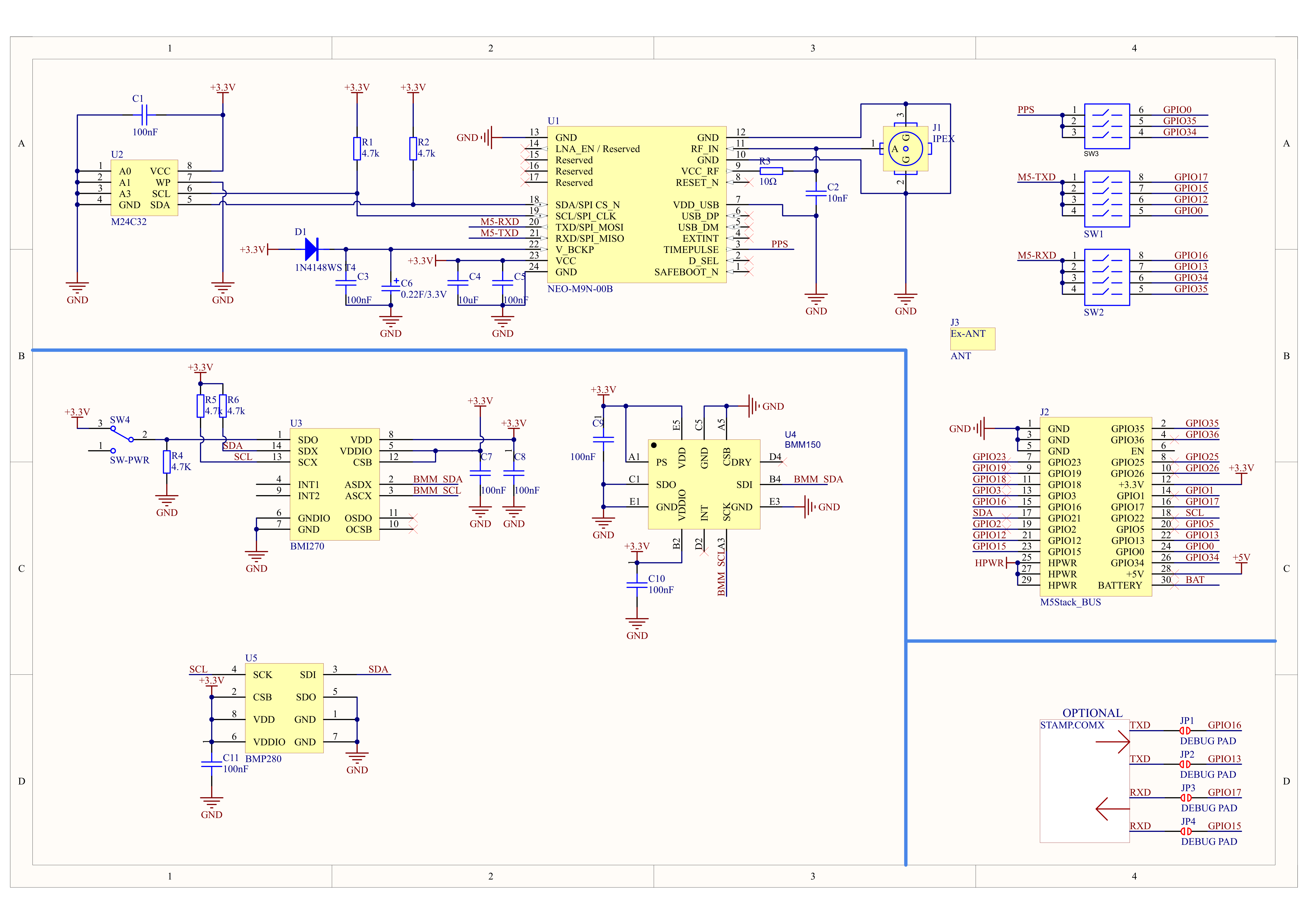
1/1
PinMap
M5-Bus
Switch
The pins marked
SW in the M5-Bus section below can be toggled via DIP switches for adapting to different controllers.| PIN | LEFT | RIGHT | PIN |
|---|---|---|---|
| GND | 1 | 2 | NEO_TXD/PPS (SW) |
| GND | 3 | 4 | |
| GND | 5 | 6 | |
| 7 | 8 | ||
| 9 | 10 | ||
| 11 | 12 | 3V3 | |
| 13 | 14 | ||
| NEO_TXD (SW) | 15 | 16 | NEO_RXD (SW) |
| I2C_SDA | 17 | 18 | I2C_SCL |
| 19 | 20 | ||
| NEO_RXD (SW) | 21 | 22 | NEO_TXD (SW) |
| NEO_RXD (SW) | 23 | 24 | NEO_RXD/PPS (SW) |
| HPWR | 25 | 26 | NEO_TXD/PPS (SW) |
| HPWR | 27 | 28 | 5V |
| HPWR | 29 | 30 | BAT |
Model Size
Datasheets
Softwares
Arduino
UiFlow1
UiFlow2
Video
Page Tools